

McTRAMP Trip Report - #9
AKA Southern Selkirk Traverse (ID) FKT. Or a silly amount of acronyms.

I really like writing trip reports, but don’t share often, as I’m careful not to give away geographical locations of special spots to the whole world. Since this one is already out there, that dilemma didn’t exist. Enjoy, it’s both picture and word heavy.
Last summer, when I decided my postpartum endurance crisis was the goal to run a 100 mile ultramarathon, I stepped into a world of unknown. Not being a “runner”, I had a lot to learn about this niche sport. Full immersion education commenced: podcasts, books, YouTube videos, anything I could find.
Before this education journey, I’d sort of hear of FKT’s, or Fastest Known Times, from the skiing world. Someone would start at the center of a town in Europe, then run to the snow with their skis, ski the mountain, and then run back. But I had no idea it was a whole thing in running. There is an official website, lots of verified routes, and even professional FKT athletes.
Perusing the website, there were a few listed in our area. One actually looked both doable and interesting as an adventure route. I kept it tucked away in my head until a couple months ago when I was laying out my 50 mile training plan for a race in July. I needed a ~50 km effort in the second week of June.
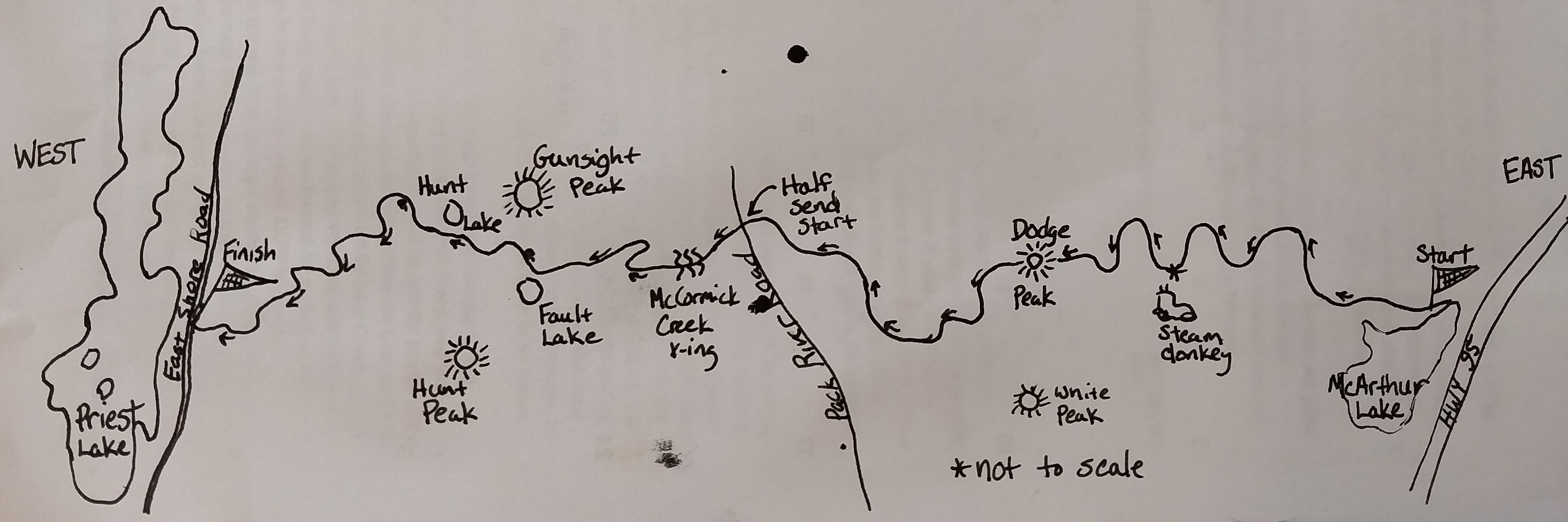
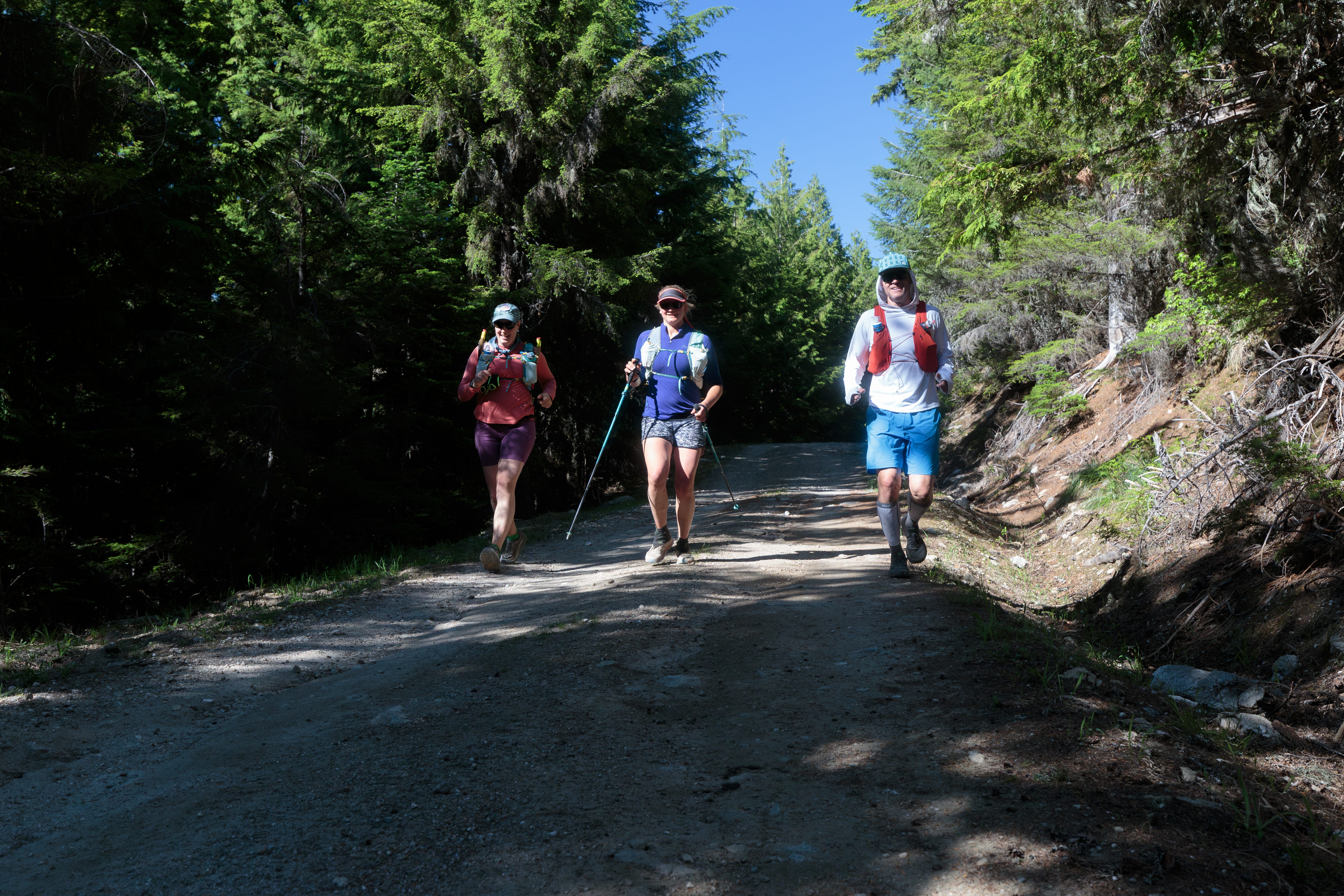
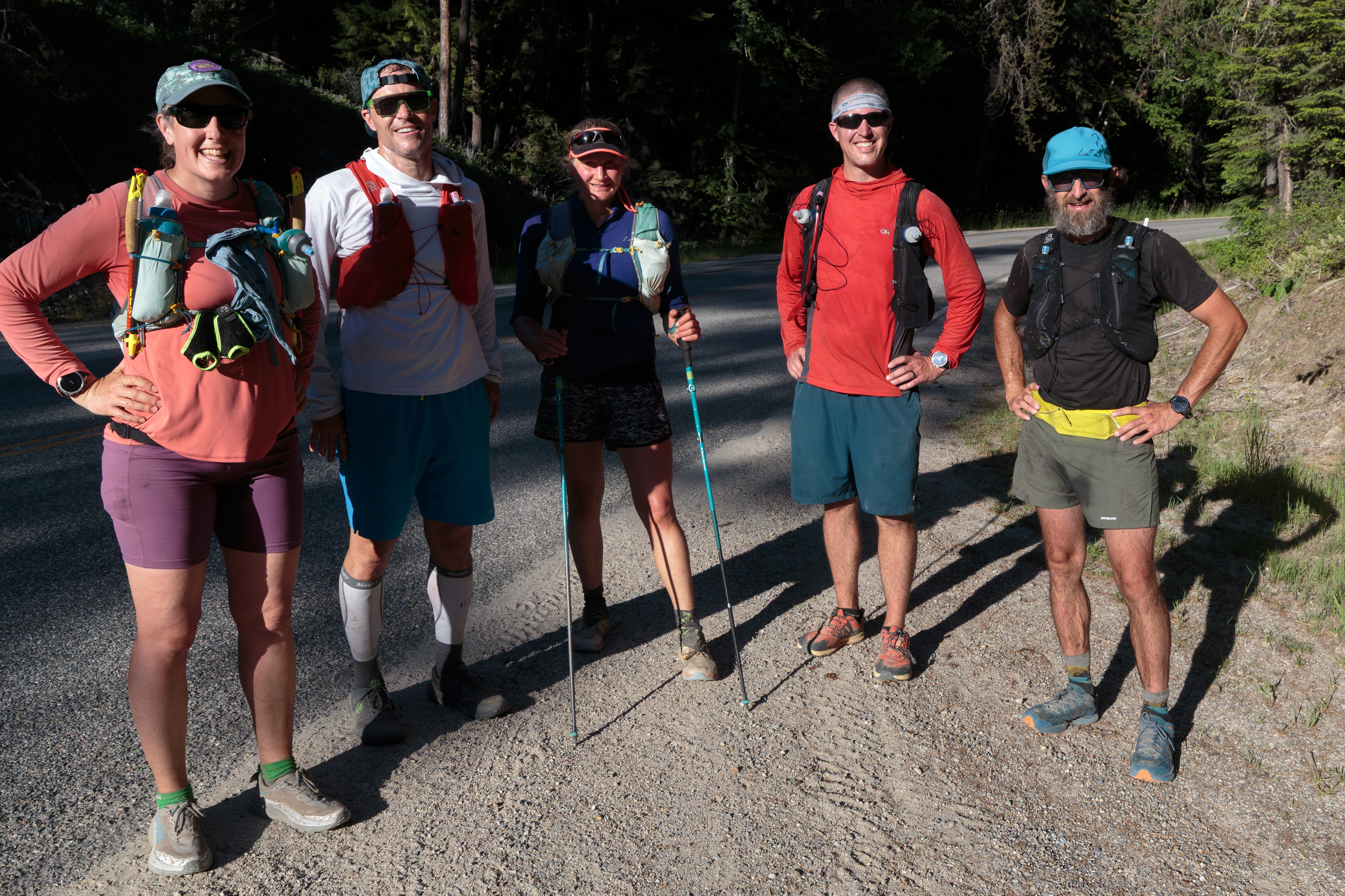
Hence the plan to run the Southern Selkirk Traverse (ID) FKT was born, which is an open route from McArthur Lake to Priest Lake along any path you choose. But obviously that level of misery fun requires company, so I had to convince friends to come along. I renamed it McTRAMP: McArthur Trail Run Across Mountains to Priest, in hopes of luring friends with a tantalizing acronym. It worked. I had a solid “yes” from Drew Mahan, a friend from skiing, and a couple of maybes for the half course. Conveniently, the 32-ish miles were split in half by the easily accessible Pack River Road.
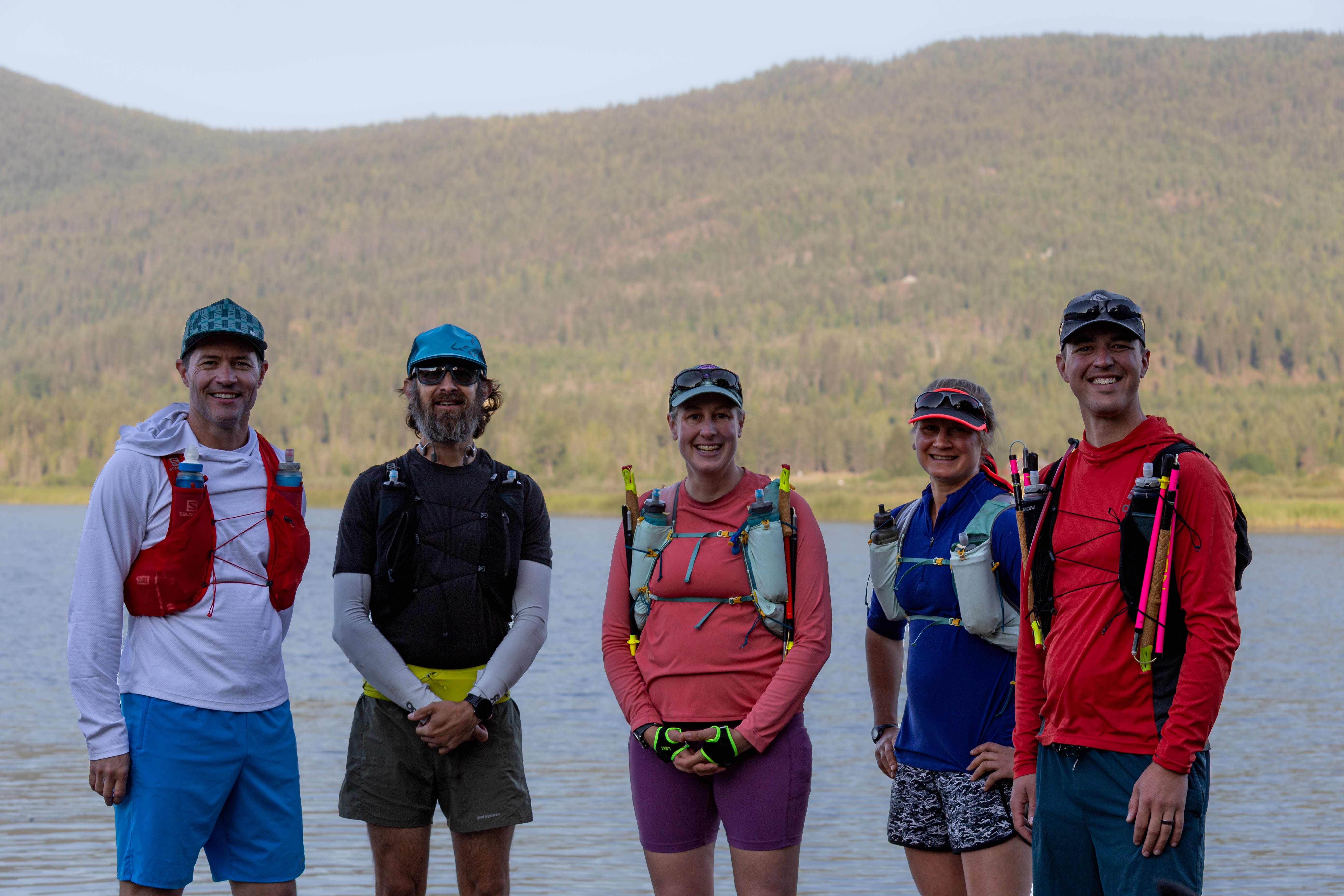
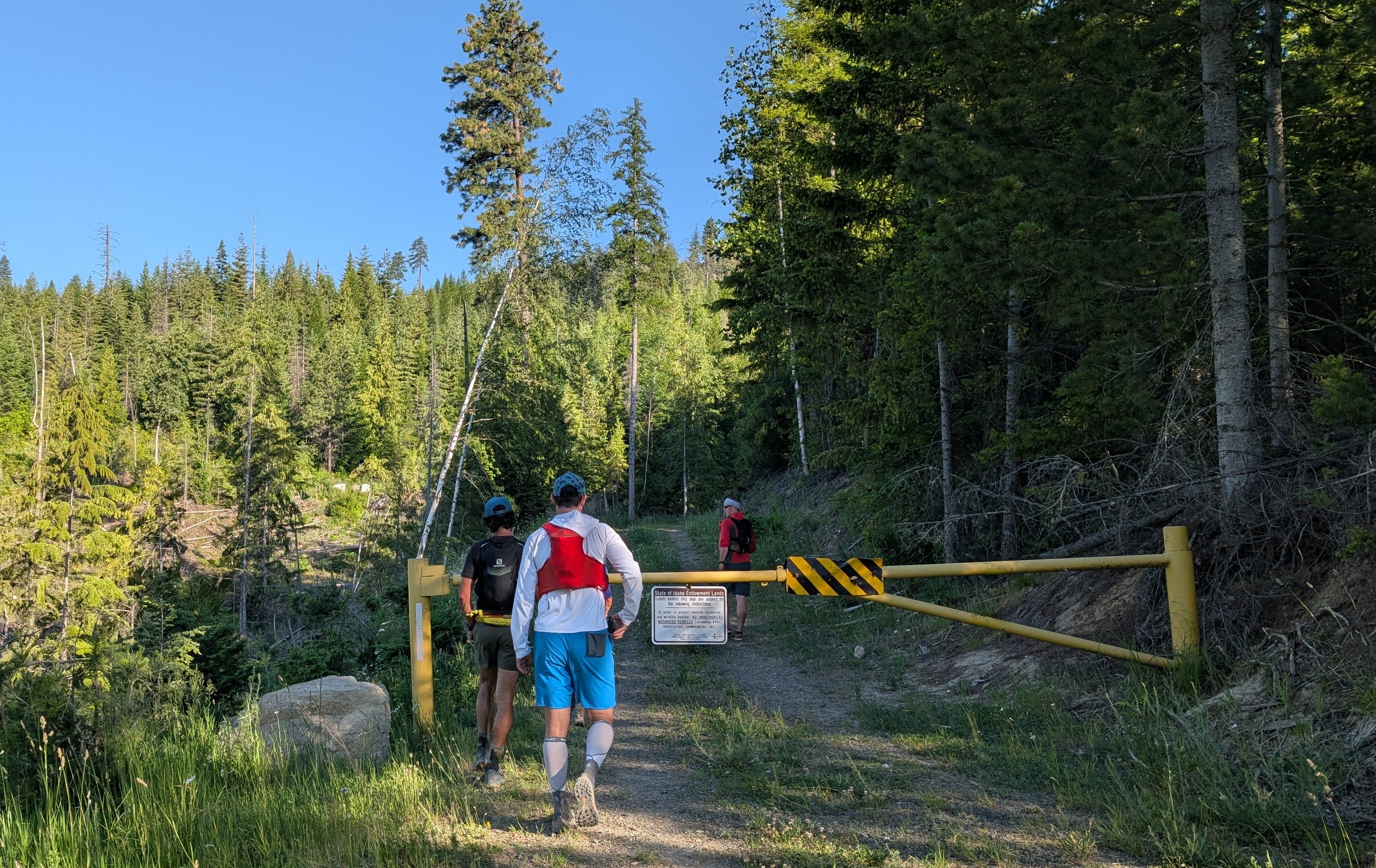
Five of us gathered on the McArthur Lake boat dock on June 9th. Drew had brought friends Aaron Boatman and Chris Hoppe. My friend Kyla Berendzen was also joining us for the first half; we’d dropped her vehicle at the Pack River the previous day. Drew’s brother, Aaron, was going to take pictures and crew.
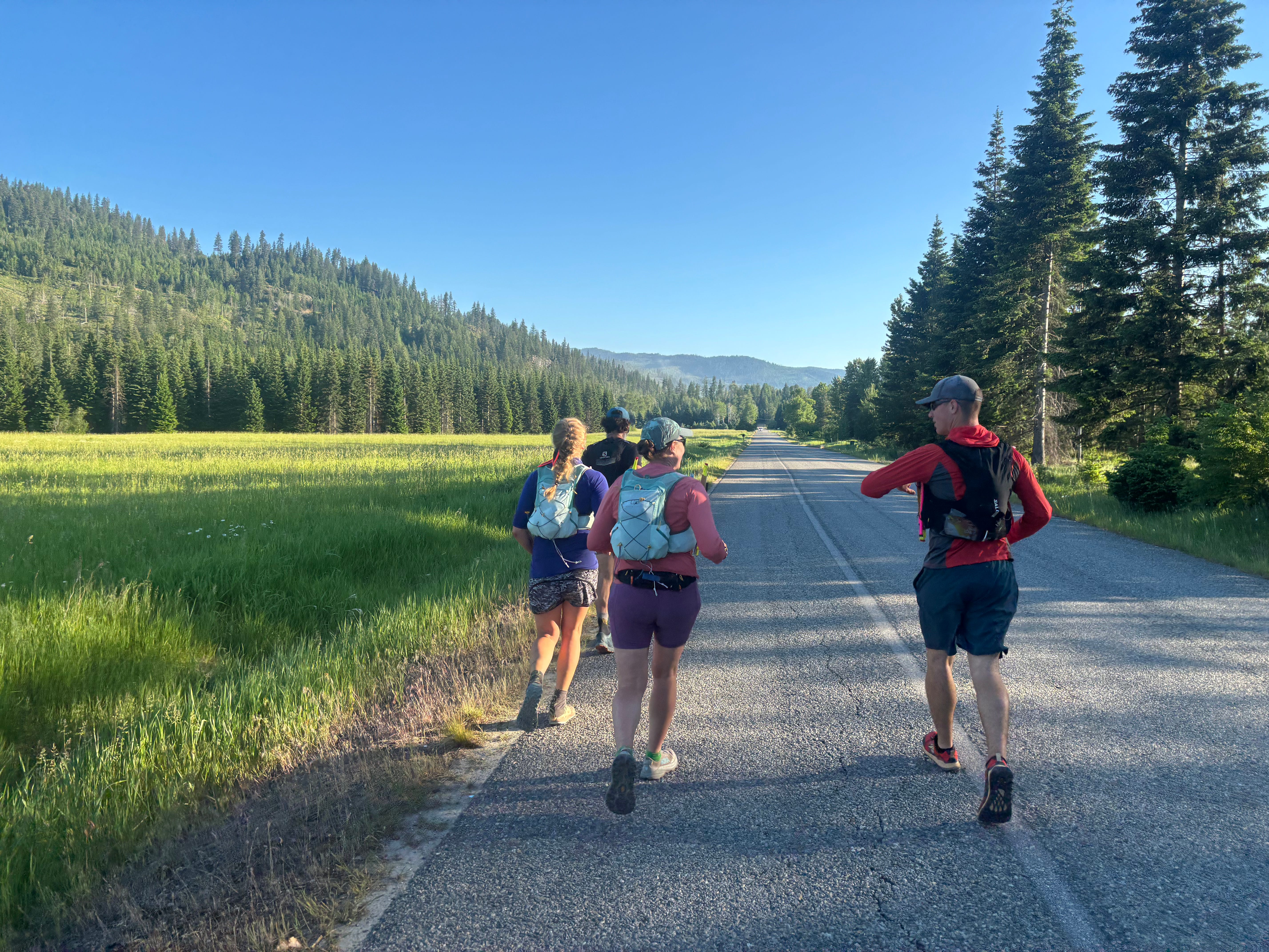
We headed out the short 2.5 mile paved section, which was surprisingly busy for a Monday morning a little after 6:00 AM. Several full log trucks made me wonder if there was active logging on our planned route. At one point, a moose popped out of the bushes next to the road, got one look at the five brightly colored runners, and promptly went back the way she came from.
The previous routes had gone up the Idaho Centennial Trail (ICT) to White Peak, then over to Dodge Peak. This “trail”, from the previous route reports, exists on the map, but not necessarily on the ground. From my knowledge of the State land below Dodge Peak and with a little help from onX, I picked a route that would cut a couple miles and skip White Peak altogether. I was about 80% confident of this plan. I’d been on the road portions at several points, but wasn’t sure how much the bushwhacking would suck. Which, given I’d never done a summer mountain adventure with three of these people, could make or break our group dynamic.
Luckily, everyone was game for the first off-road section and we did some scrambling up a timber cut and around a cliffy part. The math worked out: a 270 yard ‘shwhack cut out a mile of road! The people weren’t revolting yet.
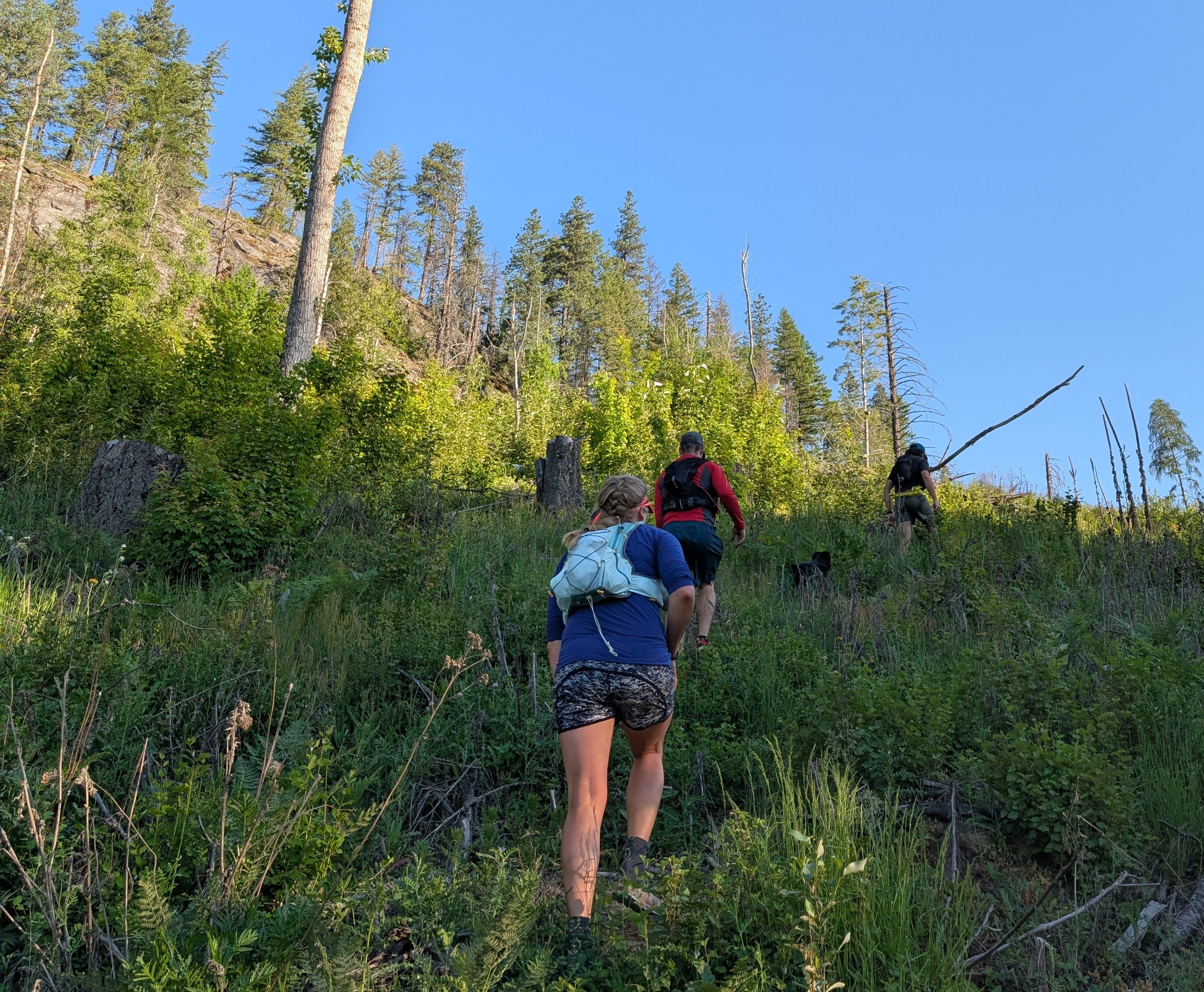
Soon, the route took us behind a closed gate. This was also a gamble, as you never know how many trees will be down or if it has been decommissioned until you check it out. Of which I hadn’t ahead of time. But it was lovely, shaded running on a slightly grassed over surface. Phew.
Tikka, Kyla’s dog, still on fresh legs, was running all over, discovering all the smells. At one point, she came tearing around a corner directly back towards us, with a mule deer hot on her tail. The deer registered us as danger before we registered it, and she veered off the road before any of us could hit the deck. Our best guess was Tikka had gotten too close to her fawn, which instigated the charge.
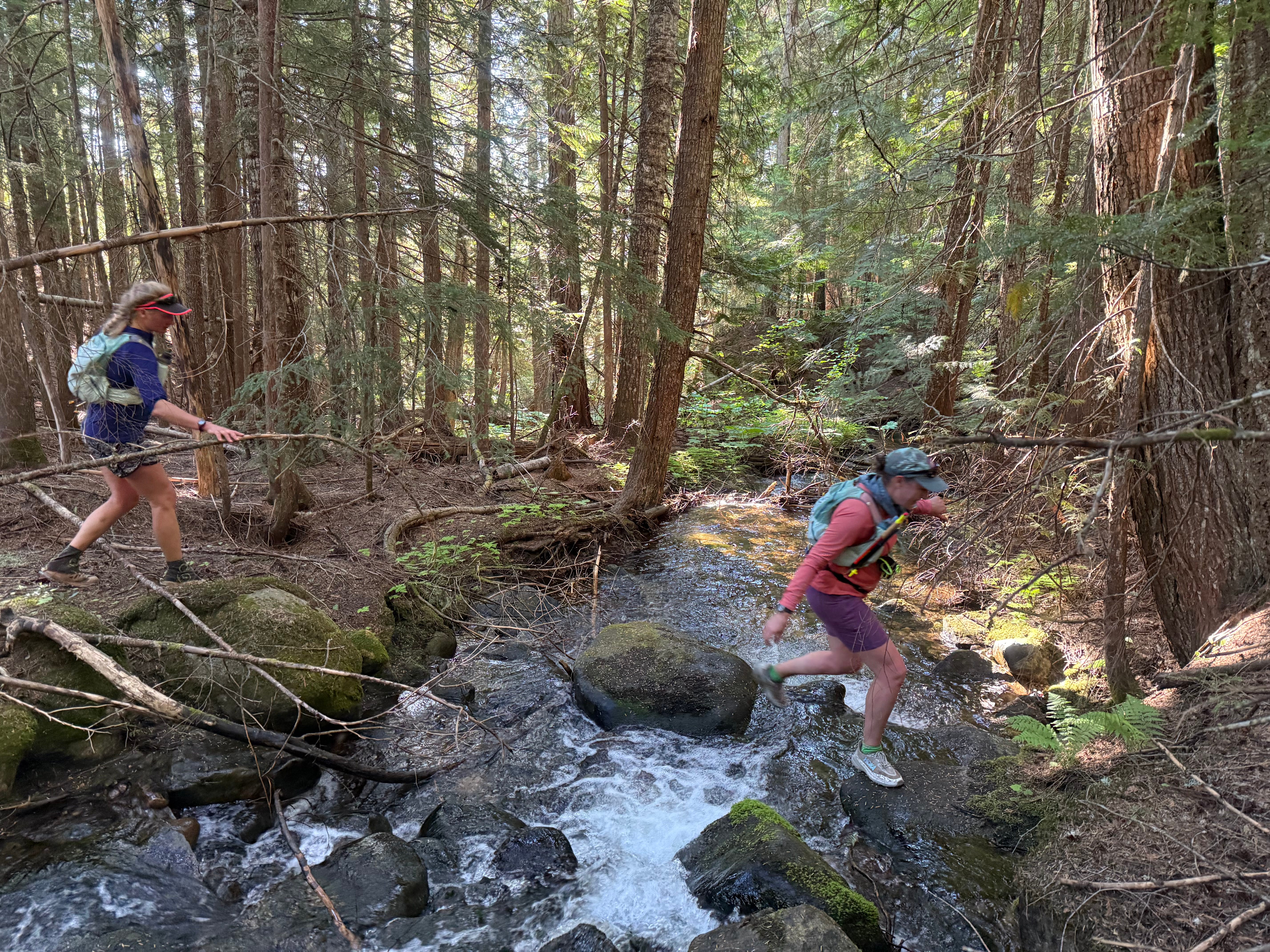
I’d been in the next section of bushwhack on a previous adventure and knew it would be a doable creek bottom or old skid trail in a fairly recent cut. Following the meandering Dodge Creek through the cedar bottom was lovely while it lasted. It was hot enough at this point that everyone was taking advantage of the cool mountain water, whether to drink or wet down clothes.
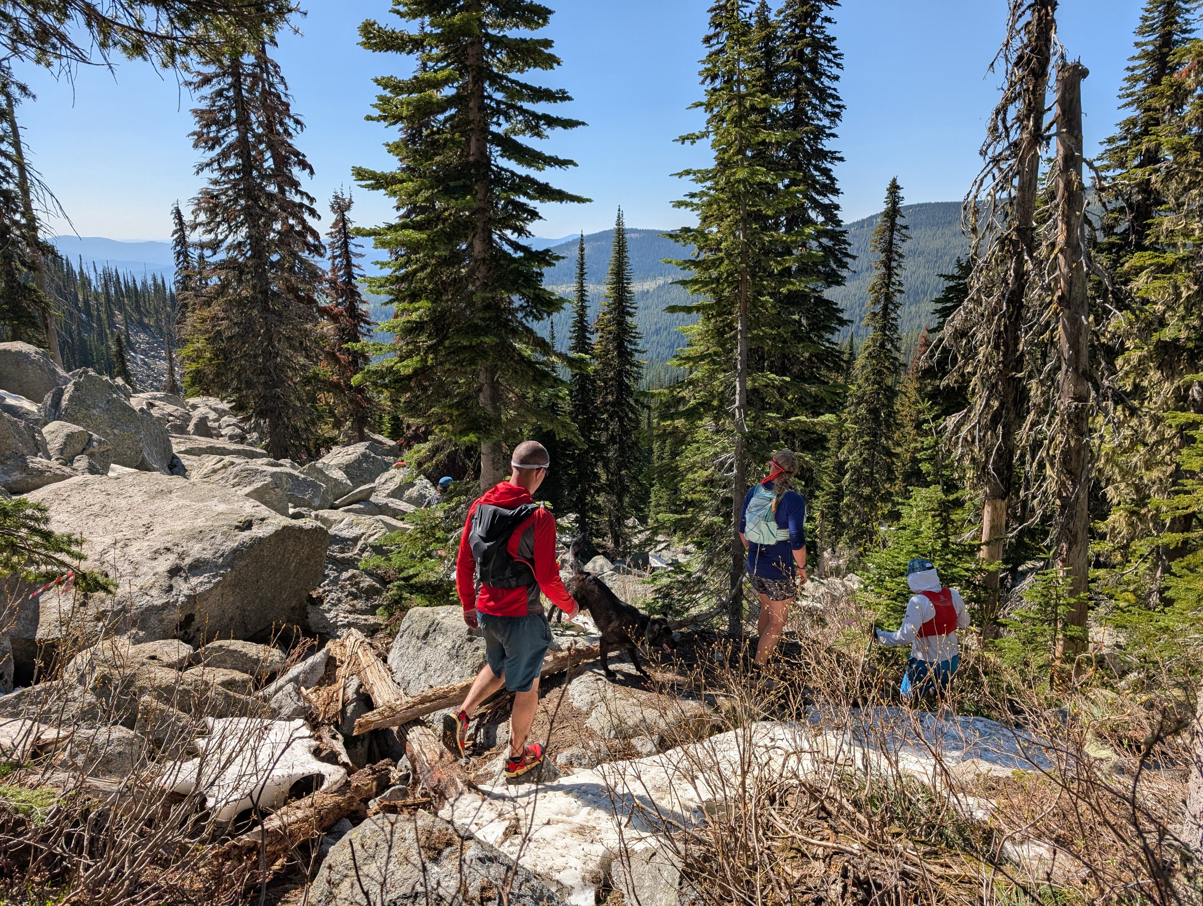
Another hot road section, signs of summer all around us. I spotted my first paint brush and bear grass of the year. The next bushwhack was the most overgrown yet, but we were able to follow animal trails winding through the alder growth. A 20 yard road breather and we dove into the woods again, leaving State land behind and entering the Kaniksu National Forest.
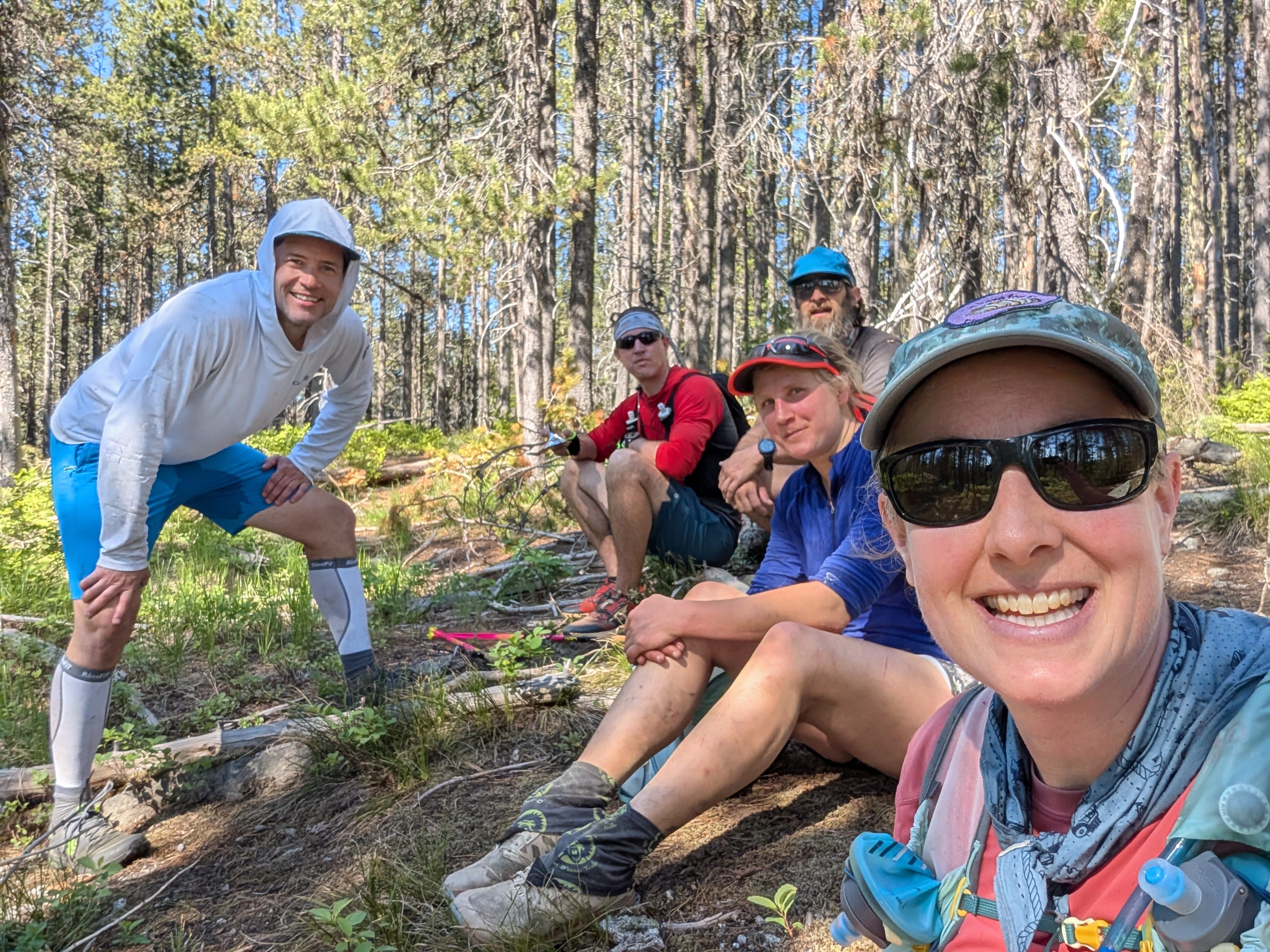
This section was typical south/east facing Selkirk off trail hiking: mature forest interspersed with rocky sections and openings with low brush. There were already green huckleberries dotting the bushes along the way. We regrouped at a knob I was calling the false summit of Dodge for a group picture and some snacks. We had successfully ascended the east lobe of the Selkirks.
A few hundred yards more of bushwhack and we popped out on the 4-wheel drive road from Dodge down to the Pack River. I could breath a sigh of relief as the rest of the route would follow the previous FKT routes, the unknown section I’d picked hadn’t turned out too badly. Or at least nobody had deserted me yet.
At this point, we all needed water and stopped at the first available source. We should have gone to the second one, as we were instantly swarmed by mosquitos from the wet meadow located near by. Lessons for next time. With three water filters and five people, Kyla and Drew were filled up first and peeled out doing the mosquito dance. Aaron next, and Chris and I last. At this point, the four wheel drive trail turned into a dirt road. Mentally we were all at the halfway point, but geographically we were still over a 1000 vertical feet from the Pack River. Fortunately, as soon as it got monotonous, you would turn another bend and get a great view of the Selkirk Crest. About a mile to go, we met Aaron M running backwards to meet us. We knew we were close then!
Cokes, ginger ale, and cold pizza in lawn chairs in the shade at the crew stop. Kyla spent the 15 minutes debating whether she should keep going or not. Drew made the point of it being kind of silly to stop now when the alpine, the best part, was still ahead. She conceded against her better judgement and all five of us were off again.
A short bushwhack and half a mile of road and we were at the Fault Lake Trailhead with the crux of the day rushing before us: the McCormick Creek crossing. I'd scouted it on Friday to make sure we could do it, but didn’t actually try to cross by myself. My conclusion: doable, but sporty. Drew blazed the way, as we held our collective breaths watching him. One by one, we all made it across, including Tikka. Aaron M, who had joined us to capture the success or mishap on camera, waved good-bye. He would have liked to have come further, but was smart enough to not cross the creek by himself on the way back.
We power hiked most of the Fault Lake trail, all of us dipping for water at the creek crossings or dousing our heads. In retrospect, this was the best seven miles of trail of the whole adventure. Smooth tread, great views, and a pace we could all converse at. We knew we’d hit snow at some point, but it was farther along than I’d expected.
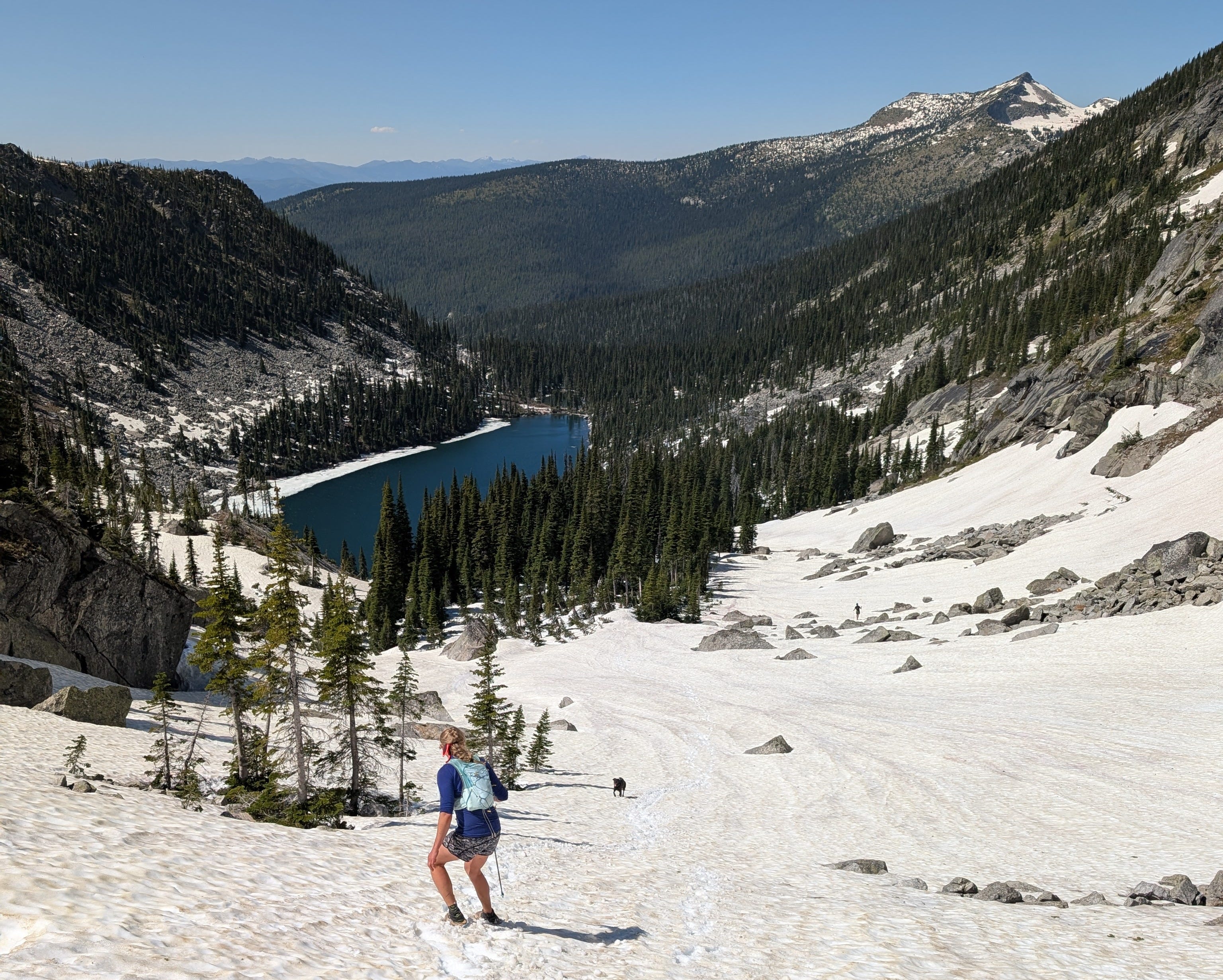
We had a few patches of snow to traverse starting about a half mile shy of the trail intersection for Fault Lake and Hunt Pass. In this area, the map doesn’t exactly match the ground (surprise!). It had been seven years since I’d last hiked Fault Lake, so I couldn’t remember if there was a sign or just a pile of rocks marking the intersection. When we finally had views of a still frozen over Fault Lake, we gave up on finding the trail and planned our own route to the Pass. Drew lead the charge, and picked our way up to the pass mostly on rock. Glacier lilies dotted the route, of which I ate many. We also stopped to snap copious pictures. At one point, Drew saw a wolf cross a ridge below us, but it was gone before anyone else could hone in on the location.
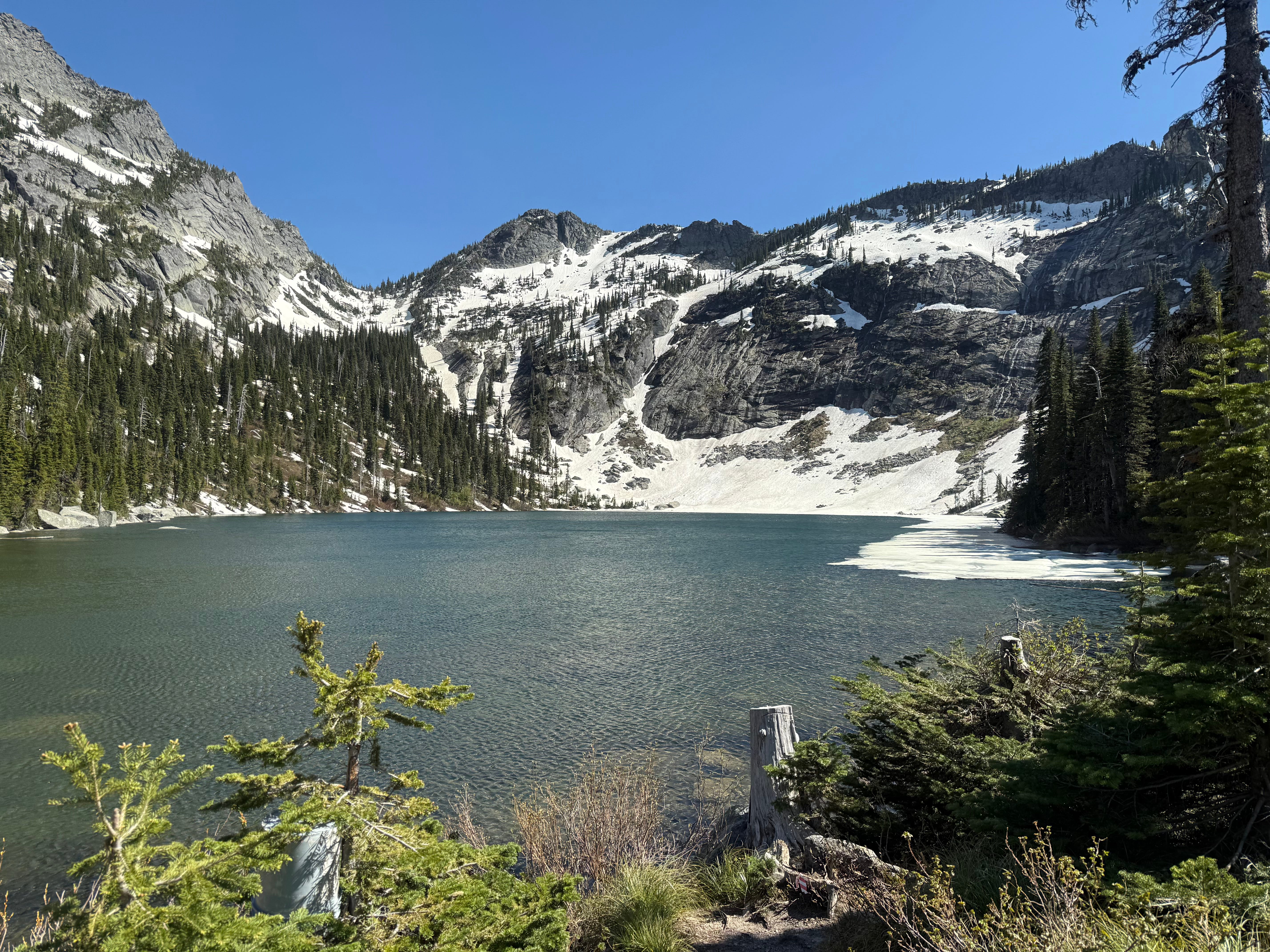
The top of Hunt Pass was filled in with snow, of which we had to ascend on for a short distance to be able to look over to the other side. From our vantage point, it was continuous snow all the way down to Hunt Lake, which only had a rim of ice on the upper end.
I was definitely worried about the snow conditions leading up to this point: was it going to be post-holing? Fortunately, my worries were assuaged as we headed down. The snowfield was perfect condition: it was soft enough we could kick steps in our sneakers, but no post-holing. We angled around Hunt Lake according to the line on the map for the ICT. Maybe this trail exists in the summer, but we sure as heck didn’t find it.
The bushwhack around the lake sucked more and more the closer we got to the shore. Shrubs concealed by a thin layer of snow or criss-crossed downed logs concealed by shrubs camouflaged each step. Every once in a while, my foot would rail slide down a leafless branch, and I would turtle ungracefully. I feared for the inside of my backpack, as I couldn’t imagine my peanut butter and banana wrap staying intact inside it’s foil cocoon after the repeated slamming. In another particularly ungraceful move, I peeled out with my stomach facing into the hill. I slid, raking branches and corn snow up the extent of my body, only stopping on my tippy toes with my hands wrapped in a death grip around a couple of shrubs. Aaron B, right behind me, unsuccessfully convinced me he hadn’t seen anything. Karma had him eating it about a 100 yards later.
Finally, we reached the lake shore and sort of a trail that added more scratches to the already bleeding knees and shins. Aaron B nicely waited until the end of the day to gloat how his compression socks saved his shins from the scratches the rest of us had.
Rather than bash brush for the last 100 yards, we chose to wade the edge of the lake in waist deep freezing water. Instant numb! There were four dudes camped at Hunt Lake who were equally flabbergasted and stupefied of where we had come from and that all of us were dunking as if the lake was a pleasant temperature.
At this point, we knew the hard part was done and all we had to do was finish. Relishing the nice rock seats overlooking the view of Hunt Lake and Pass, we had our longest sit down break since the Pack River. Carefully opening my pack, I was astonished my wrap was still intact. No peanut butter or smooshed banana mess!
Of course, we were wrong about the hard part being done. The trail out from Hunt Lake is only a mile long, but it is a very long mile on shot quads. The entire way was scrambling from one giant boulder to another, following small pieces of pink flagging tied to the sparse trees. Kyla spotted the love note my friend Laura had left us in the snow. She had run up from the Priest side in hopes of meeting us, but had a hard departure time of 4PM to get her kiddo from daycare. Our pre-run estimates put us at Hunt Lake between noon and 4:00 PM: we were at the lake at 3:00. Sadly, she’d already turned around by then to reach her car at 4:00.
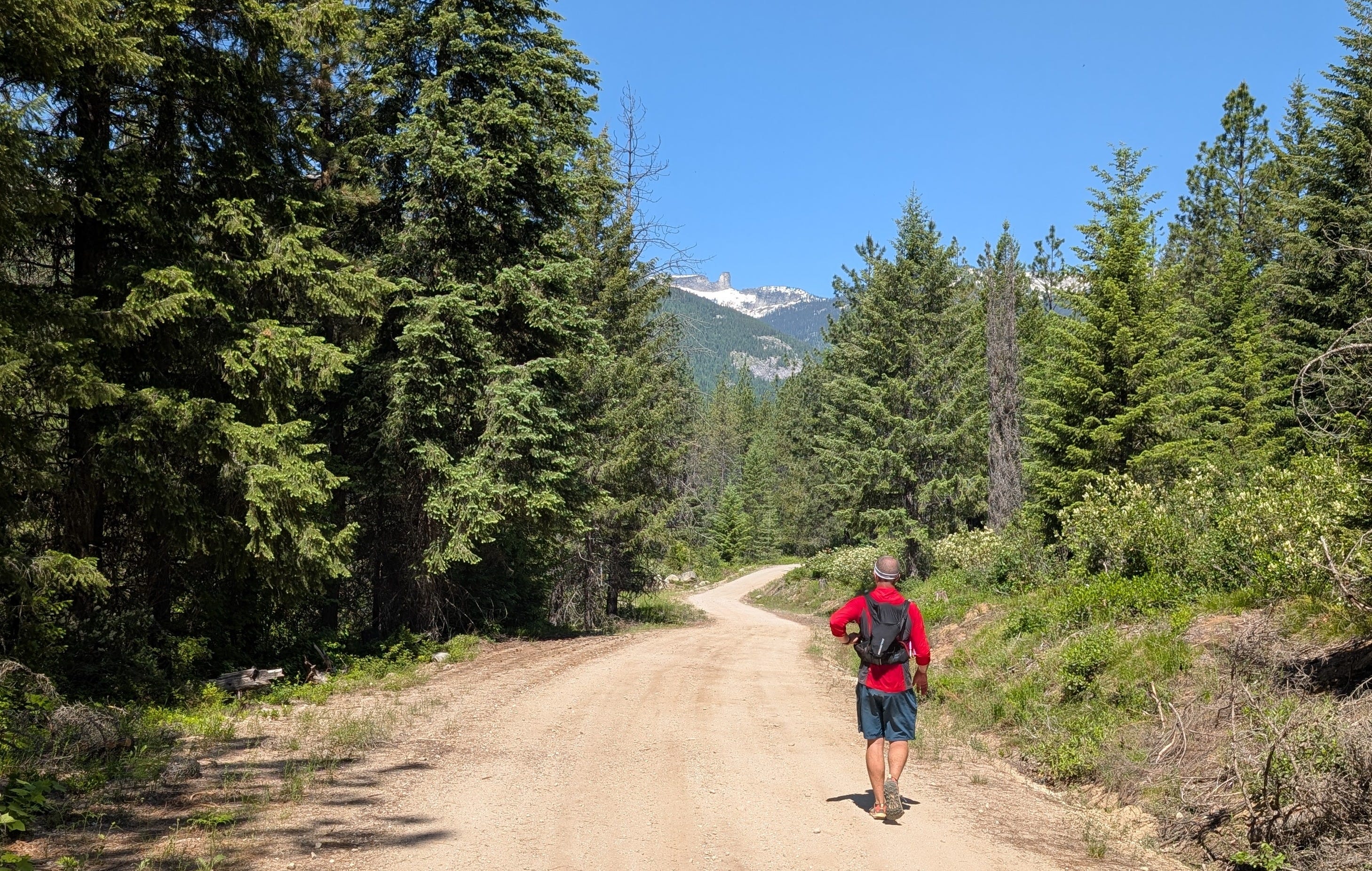
Finally the easy, downhill miles began. Mostly shaded for the first couple, it was rather pleasant to actually be running again. Soon there was a figure coming up the road towards us and we met up with Aaron M. Quick fill of water from the van and we were on our way for the final five miles. It started getting hotter and glimpses of Priest Lake showed it impossibly far away still. But yet we trudged along.
I started falling back as my default running cadence was slower than the rest. Right when I thought I would have to start walking, I remembered I still had two gels in my vest. Salvation! I downed one right when I saw a four mile tree marker. I told myself I’d take the second one when I hit the two mile mark. In the meantime, there was a section of road that had two switchbacks of which the previous FKT route had cut. I knew Kyla and Arron B probably had missed them and were taking the road; there was a chance I could catch up with them again. I bombed down over the cutbank and followed an easy game trail. Bam, I could see them coming down the road and jumped out in front of them, surprising everyone. Another cutoff and another mile of road led to a view of the truck where I’d staged it the day before. Soon the end was in sight and the feet landed on the pavement of the East Shore Road. Stop the watch, officially done the FKT route!
Stats: 34.09 mi, 12:02:23, Total Ascent 6,843 ft, mixed-gender supported FKT (pending).
More about the FKT: https://fastestknowntime.com/route/southern-selkirk-traverse-id